
The Art of Navigation: How to Effectively Use a Map to Get Where You’re Going
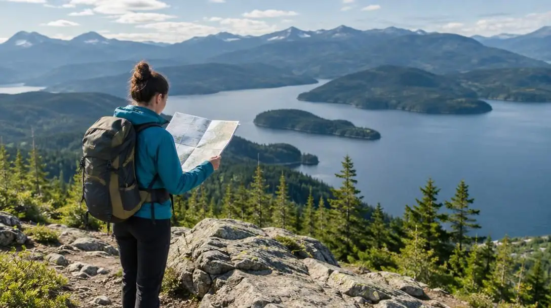
Navigation is an essential human skill that stretches back to ancient antiquity. Long before automated voice prompts and satellite receivers dictated travel routes, explorers, traders, and travelers relied on their ability to interpret visual representations of the terrain around them. Whether hiking across wilderness backcountry, motoring along highway networks, or sailing open waterways, understanding how to read and apply a map remains the cornerstone of safe, efficient movement across unfamiliar territory.
In our modern era dominated by automated digital directions, the foundational art of navigating using physical and visual representations of the world remains indispensable. Digital screens can run out of battery, shatter upon impact, or lose satellite reception in deep canyons and dense forests. Developing proficiency with maps sharpens your innate spatial awareness, builds self-reliance, and equips you with a reliable navigation method that never suffers from software glitches or depleted power reserves.
Key takeaways
- Physical maps provide an expansive, bird’s-eye perspective of landscape connections that small digital screens cannot easily replicate.
- Understanding map scale is vital for translating printed measurements into accurate real-world distances and travel times.
- Orienting a map to true or magnetic north aligns printed symbols directly with the physical features visible around you.
- Successful navigation is an active, continuous process of tracking your position before you encounter unexpected obstacles or become lost.
The evolution and lasting significance of maps
For thousands of years, humans have relied on maps to trade goods, conduct seasonal migrations, explore uncharted lands, and organize developing settlements. Early navigators tracked the nightly progression of stars, identified distinctive mountain ridges, and followed coastal contours, carving these critical visual cues onto stone, soft clay tablets, wood, and animal parchment. As mathematical understanding, surveying instruments, and geographic projection methods matured over generations, rough conceptual sketches evolved into the highly accurate, measured representations travelers use today.
Despite the prevalence of turn-by-turn mobile navigation, physical maps retain clear advantages. A paper map provides an unobstructed, broad regional view that electronic screens struggle to match. Looking across an expansive printed sheet allows you to understand how mountain ranges, river basins, access roads, and urban centers interconnect. Rather than passively following turn prompts, engaging with a physical map transforms navigation into an active exercise in situational awareness and geographic literacy.
Mastering the mechanics of navigation turns travel into an active, thoughtful experience rather than a passive exercise in following electronic commands.
Understanding the primary types of maps
To travel effectively through any environment, you must choose the right map for your specific mode of transit and landscape. Different maps highlight distinct details while omitting irrelevant data, ensuring that travelers receive the most actionable information for their journey.
| Map Type | Primary Audience | Key Features Displayed | Optimal Environment |
|---|---|---|---|
| Topographic Map | Hikers, backpackers, explorers | Contour lines, elevation, rivers, peaks | Mountains, backcountry trails, wild terrain |
| Road Map | Motorists, road trippers, truckers | Highways, surface streets, cities, exits | Paved thoroughfares, urban and rural road networks |
| Nautical Chart | Sailors, boaters, mariners | Water depths, channels, hazards, shorelines | Harbors, open oceans, coastal passages |
| Aerial Photograph | Surveyors, analysts, field researchers | Direct photographic imagery, vegetation, buildings | Mixed terrain requiring literal surface views |
Topographic Maps
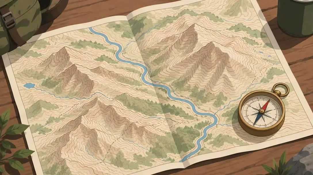
- Core Purpose: Portrays three-dimensional terrain changes on a flat surface
- Key Feature: Specialized contour lines revealing slope steepness and elevation
- Primary Users: Hikers, backpackers, mountaineers, and backcountry explorers
Topographic maps are designed to show elevation changes alongside natural and human-made features like mountain peaks, ridgelines, valleys, and rivers. By using specialized contour lines—curves connecting points of equal elevation—these maps show the shape, height, and steepness of the terrain. When contour lines are closely spaced, they indicate a steep incline or cliff; when spaced far apart, they signify gentle slopes or flat ground. For hikers and wilderness explorers, a topographic map is essential for anticipating physical effort, identifying switchbacks, and avoiding dangerous drop-offs.
Road Maps
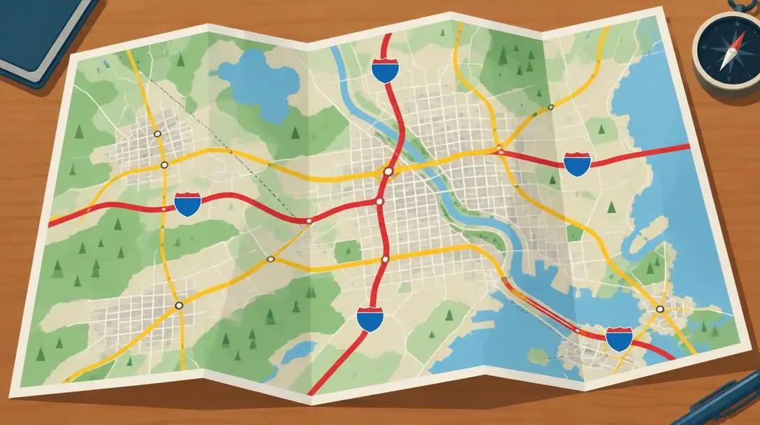
- Core Purpose: Facilitates overland vehicle travel across structured networks
- Key Feature: Clear hierarchy of highways, secondary streets, and intersections
- Primary Users: Motorists, commercial drivers, and long-distance road travelers
Engineered specifically for surface vehicle transit, road maps emphasize vehicular infrastructure such as interstate highways, state roads, local streets, freeway exits, and city boundaries. By stripping away extraneous wilderness detail, road maps highlight navigational junctions, toll ways, bridges, and rest stops. They allow motorists to plan long-distance driving routes, assess bypass options around congested metropolitan centers, and navigate sprawling municipal networks without losing track of major arteries.
Nautical Charts
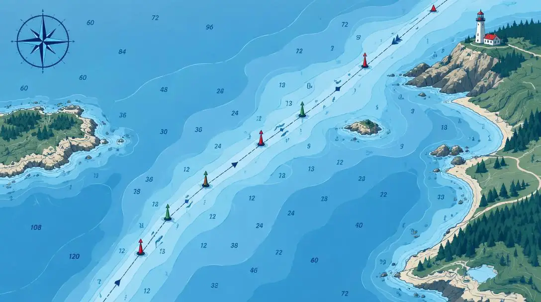
- Core Purpose: Guides safe maritime navigation across navigable waters
- Key Feature: Depth soundings, underwater hazards, and navigational aids
- Primary Users: Boat captains, sailors, navigators, and maritime pilots
Nautical charts serve as the marine equivalent of topographic and road maps, crafted exclusively for mariners operating on rivers, lakes, bays, and oceans. These charts provide critical hydrographic information, including measured water depths (soundings), dynamic shoreline profiles, sandbars, coral reefs, sunken wrecks, and managed sea channels. They also identify navigational aids such as buoys, lighthouses, and daymarkers, ensuring that vessels avoid grounding and traverse narrow channels safely.
Aerial Photographs
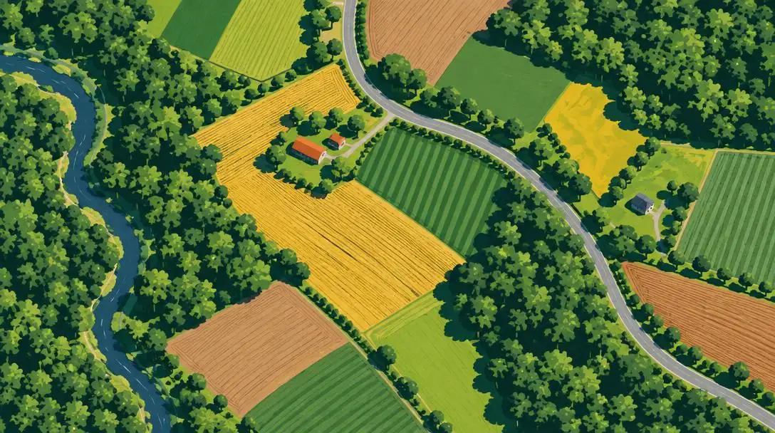
- Core Purpose: Delivers an unfiltered, bird’s-eye photographic view of the ground
- Key Feature: Real-world photographic records captured from aircraft or sensors
- Primary Users: Land planners, emergency responders, scientists, and outdoor travelers
Captured from overhead airplanes or airborne optical sensors, aerial photographs present a direct photographic record of the earth’s surface. Unlike cartographic maps that use abstract symbols to represent landmarks, aerial imagery displays ground conditions exactly as they appear from above. Navigators and surveyors use aerial photographs to examine literal vegetation cover, visible forest trails, human infrastructure, agricultural developments, and natural waterways that standard drawn maps might omit or simplify.
Core mechanics: Map scale and map orientation
Every successful journey depends on two fundamental cartographic principles: map scale and map orientation. Without an accurate grasp of these two concepts, reading a map is reduced to guesswork.
Map scale describes the mathematical ratio between a measured distance on the printed sheet and the actual distance across the ground. A scale expressed as 1:50,000 indicates that one unit of measurement on the map represents 50,000 of those same units in the real world. For example, a single centimeter measured across the surface of the map equates to 50,000 centimeters—or exactly 500 meters—across the actual land. Paying close attention to scale when planning your route is vital because it directly dictates both your total travel distance and realistic travel time estimates. Miscalculating scale can cause an outdoorsperson to drastically underestimate the daylight and energy required to complete a trek.
Map orientation refers to how the map sheet aligns with real-world cardinal directions. On almost all modern maps, geographic north sits squarely at the top edge of the paper unless an alternative directional arrow specifies otherwise. When your map is oriented correctly, the features drawn on the sheet sit in the exact spatial relationship to the features in your surrounding environment. If a river is marked to the left of a mountain peak on your oriented map, looking outward toward that actual peak will place the real river to your left as well.
How map navigation works in the field
Navigating effectively with a map requires a continuous feedback loop between the abstract symbols on the paper and your immediate physical environment. Rather than checking a sheet only when you suspect you are off track, experienced navigators maintain ongoing situational awareness as they travel.
At the center of this process is constant verification. As you travel along a trail, road, or waterway, you track your progress by cross-referencing prominent visual landmarks—such as rock spires, valley bends, or crossroads—against the markings on your sheet. By holding your map so its north marker points toward real-world north, you establish a direct correlation between your field of view and the printed symbols. When paired with a magnetic compass or an electronic GPS unit to confirm headings, a map becomes an intuitive guide that confirms where you have been, validates where you are standing, and reveals what terrain lies ahead.
Step-by-step guide to using a map for navigation
Navigating through unfamiliar territory with a map requires a methodical approach that starts at your desk and continues through every stage of your excursion.
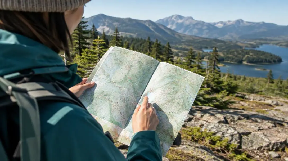
- Plan your route thoroughly: Before departing, examine the map to identify your exact starting point, your destination, and the entire tract of land between them. Study the terrain closely for potential obstacles such as steep inclines, broad rivers, or marshlands. Identify obvious visual checkpoints—such as highway intersections, trail forks, or distinct ridgelines—where you can stop and verify your location as you travel.
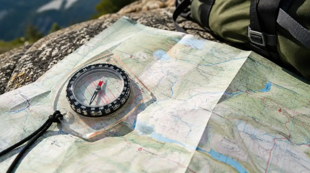
- Orient the map to true or magnetic north: Lay your map flat on a level surface or hold it steady in front of you. Place a magnetic compass or handheld GPS unit flat on the sheet, aligning the edge with the map's north-south grid lines. Rotate the entire map sheet until the north indicator on the paper matches the direction indicated by your compass needle or device. This aligns every symbol on the map with the physical geography around you.
- Follow the route using active observation: Begin traveling along your planned route while constantly monitoring your environment. Verify your progress by matching visible landmarks—such as bridges, switchbacks, and mountain peaks—to the markings on your sheet. Monitor your rate of travel using time tracking or pace-counting methods to ensure your estimated distance covered matches the scale on the paper.
- Adjust your route when obstacles arise: If you encounter unforeseen impediments such as washed-out trails, closed roads, or deteriorating weather, re-examine your map immediately. Locate your exact position relative to your destination, evaluate adjacent terrain for safe bypasses, and trace a viable secondary route that circumvents the hazard without leading into hazardous terrain.
Common navigation mistakes to avoid
Even travelers with a sound theoretical knowledge of cartography can make critical errors when navigating in the field. Avoiding these common mistakes will keep your excursions safe and on course:
- Failing to track your current location: The most frequent mistake is stowing the map away and only pulling it out after becoming lost. Pinpointing your location on a map when you have no idea where you are is exceptionally difficult. Track your progress continuously from landmark to landmark.
- Misinterpreting map scale: Rushing to calculate travel times without verifying the map scale leads to poor pacing, mismanaged daylight, and physical exhaustion when a seemingly short stretch turns into a grueling multi-hour hike.
- Ignoring contour lines and elevation changes: On topographic maps, choosing the straightest line between two points can lead you directly into sheer cliffs, deep ravines, or boulder fields. Always assess contour line density to understand the vertical effort required.
- Navigating with an unaligned map: Holding a map upside down or sideways forces your brain to mentally rotate every turn and geographic feature. This cognitive load regularly results in taking the wrong fork at trail junctions.
- Relying exclusively on electronic tools: Carrying only a phone or GPS receiver leaves you vulnerable to dead batteries, water damage, screen fractures, and signal loss. A physical map serves as an indispensable primary tool or emergency backup.
Enhancing your navigational skills and gear
Once you are comfortable with basic route finding and map alignment, you can enhance your precision and resilience outdoors by incorporating additional practices into your trips.
First, practice integrating your map with a traditional magnetic compass. By learning how to take field bearings from natural landmarks and plot those angles directly onto your map, you can pinpoint your exact location through triangulation. This skill is critical when navigating across featureless terrain, dense forest canopies, or heavy fog where long-distance visibility is compromised.
Second, calculate how changing environmental conditions affect your travel pace. Inclement weather, deep mud, loose scree, heavy snow, and the arrival of darkness will significantly reduce your walking or driving speed. Factoring these environmental variables into your route planning ensures that your time estimates remain realistic and safe.
Finally, safeguard your navigational tools against the elements. Standard paper maps tear easily and quickly disintegrate when exposed to rain, sweat, or wind. Protect your maps by placing them inside transparent, waterproof map cases, sealing them inside durable ziplock pouches, or purchasing maps printed on synthetic, tear-resistant waterproof papers.
Frequently asked questions
Which direction is usually at the top of a map?
On almost all modern printed and digital maps, north is oriented toward the top of the sheet unless a specific directional compass rose or orientation arrow indicates otherwise.
What does a 1:50,000 map scale actually mean?
A 1:50,000 scale means that one unit of measurement on the map equals 50,000 of those same units in the real world. For example, one centimeter on the paper represents 50,000 centimeters, or 500 meters, on the ground.
Why are contour lines important on topographic maps?
Contour lines show elevation changes and the shape of the terrain. Closely spaced lines indicate steep slopes or cliffs, while widely spaced lines represent flat land or gentle inclines, helping travelers avoid impassable grades.
How do you orient a map when you are outdoors?
Place your map flat, set a compass on top of it aligned with the north-south grid lines, and rotate the paper until the map's north indicator points in the exact same direction as the compass needle.
Why should I carry a physical map if I have GPS on my phone?
Mobile phones and GPS units rely on battery power, satellite reception, and delicate electronic screens that can fail in cold weather, deep wilderness, or after accidental drops. A physical paper map requires no power and provides a dependable backup.
The bottom line
The art of navigation is not a relic of the past; it is an empowering life skill that connects you directly to the landscapes you explore. By learning to select the right map, interpret map scale, maintain proper orientation, and verify your surroundings against cartographic symbols, you build self-reliance that technology cannot duplicate. Whether you are driving unfamiliar roads or backpacking across remote backcountry, mastering map navigation ensures you can confidently find your way forward and return home safely.